10 Real-World Applications Where Drone Methane Surveys Deliver Better Results
Drone methane surveys deliver rapid, accurate gas leak detection across complex industrial sites. Unmanned aerial platforms pinpoint fugitive emissions, protect field technicians from hazards, improve regulatory compliance, and cut operational monitoring costs compared to traditional manual inspections.
Key Takeaways:
- Aerial gas detection pinpoints invisible methane leaks faster than ground crews.
- Drones eliminate the need to put surveyors into dangerous high-risk zones.
- Automated flight planning ensures repeatable data collection for compliance reporting.
- Precise quantification helps industrial operators prioritise critical repairs instantly.
Methane monitoring is changing rapidly across global industrial sectors. Traditional foot patrols are slow and miss critical elevated leaks. Aerial inspections provide a safer, faster alternative for site operators.
Aerial sensors capture high-resolution gas absorption data in real time. Surveyors can now scan expansive facilities in minutes rather than days. Operational efficiency increases while safety risks disappear completely.
Unmanned platforms detect microscopic gas plumes from safe stand-off distances. Operators deploy specialised payloads over hazardous zones with minimal setup. The resulting data transforms how companies handle environmental asset management.
10 Real-World Applications Where Drone Methane Surveys Deliver Better Results
Here is a look at the different real-world scenarios that are helped by the accuracy and effectiveness of drone methane surveys:
Industrial Infrastructure Inspections
Energy production facilities feature sprawling network footprints. Industrial operators require continuous monitoring to prevent severe atmospheric losses.
1. Offshore Oil and Gas Platforms
Offshore oil rigs present extreme operational hazards for human inspectors. Drone Methane Surveys scan dangerous flare stacks and hard-to-reach high-pressure lines. Surveyors map gas leaks without shutting down active production machinery.
2. Upstream Onshore Well Pads
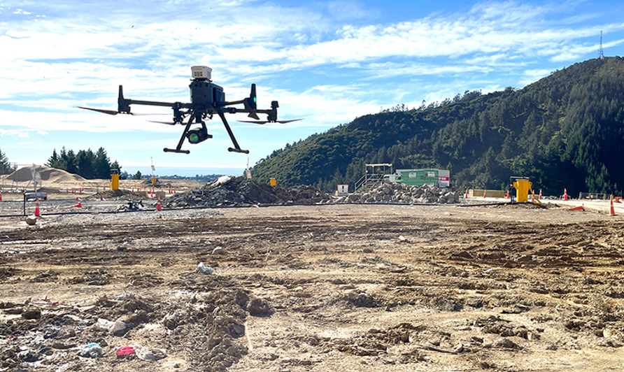
Remote onshore well sites often span thousands of square kilometres. Operators mount optical gas imaging payloads onto a UGCS Drone to execute automated multi-site flight plans. Flights cover dozens of dispersed well pads in a single day.
3. Midstream Pipeline Transmission Networks
Natural gas transmission pipelines cross difficult terrain like forests and rivers. Aerial platforms fly along linear rights-of-way to locate underground pipeline ruptures. The system tags exact GPS coordinates for emergency maintenance crews.
4. Natural Gas Storage Facilities
Underground storage sites require comprehensive, routine perimeter monitoring. Aerial lidar sensors map fugitive emissions across massive storage fields rapidly. Operators receive immediate alerts when gas concentrations exceed safe thresholds.
Waste Management and Utilities
Municipal waste facilities and urban utility grids emit significant fugitive gases. Aerial monitoring replaces imprecise manual sniffing methods across these wide areas.
5. Active and Closed Landfill Sites
Landfill operators must quantify methane migration to meet strict environmental standards. Aerial mapping identifies cap cracks and malfunctioning gas extraction wells effortlessly. Operators analyse gas distribution heatmaps to optimise surface collection systems.
The performance metrics below illustrate the operational gains achieved by transitioning from traditional ground walks to aerial surveys.
| Inspection Metric | Traditional Foot Patrols | Aerial Drone Inspections |
| Coverage Rate | 2 to 5 hectares per day | Up to 100 hectares per day |
| Inspector Safety | High exposure to toxic gas | Zero hazard exposure |
| Data Resolution | Manual spot measurements | Continuous spatial heatmaps |
| Setup Time | Extensive site logistics | Under 15 minutes |
Table 1: Comparing the Performance of Survey Methods
6. Wastewater Treatment Plants
Wastewater facilities host large anaerobic digestion tanks and open lagoons. Operators often use specialised sensors that help them monitor digester lids, while avoiding erecting expensive scaffolding. The data ensures regulatory compliance and cuts labour costs dramatically.
7. Urban Gas Distribution Networks
City gas utilities face complex structural barriers during routine inspections. Aerial units fly above traffic to detect leaks around meters and suburban mains. The approach cuts inspection times while not disrupting daily urban traffic.
Agriculture and Environmental Science
Large volumes of methane are released due to agricultural and environmental changes. Aerial survey systems help scientists and farm managers to precisely track these emissions.
8. Agricultural Livestock and Manure Lagoons
Large dairy operations can generate substantial methane emissions due to open manure storage. Drone Methane Surveys quantify emissions across large open slurry lagoons easily. Farmers use this data to optimise methane recovery for bioenergy production.
9. Thawing Permafrost and Wetland Research
Climate researchers usually track natural emissions from the melting Arctic permafrost and the peatlands. Researchers often use a custom-configured UGCS Drone for collecting precise spatial gas maps over fragile ecosystems. The lightweight setup leaves zero physical footprint on delicate tundra environments.
10. Coal Mine Venting and Abandoned Shafts
Abandoned coal mines continue leaking methane long after closure, especially into local environments. Aerial platforms are capable of locating unrecorded vent shafts hidden under the dense forest canopies. Environmental agencies prioritise sealing projects based on accurate aerial gas flux numbers.
See also: How Blockchain Technology Is Changing the Financial Industry
Strategic Advantages of Aerial Gas Detection
Selecting the correct inspection platform directly impacts site safety and data quality. Modern survey units combine precise flight navigation with sensitive gas payloads.
The overview below highlights how key drone survey features solve core industrial inspection challenges.
| Technology Feature | Operational Function | Direct Industry Benefit |
| Tunable Diode Laser (TDLS) | Detects methane concentration down to 1 ppm-m | Eliminates false-positive gas readings |
| Automated Terrain Following | Maintains constant altitude over uneven ground | Ensures consistent survey measurement quality |
| Real-time Data Streaming | Transmits live gas maps directly to ground control | Enables immediate emergency response decisions |
Table 2: Core Capabilities of Survey Payloads
Integrated flight control software manages terrain following automatically. Operators set exact flight speeds to maintain optimal sensor integration times. The collected data integrates seamlessly into existing enterprise GIS software suites.
Final Verdict
Aerial gas detection replaces slow manual ground inspections across modern industrial assets. Flying specialised payloads over complex facilities improves data accuracy, protects technicians from hazardous environments, cuts operational expenditure, and helps site managers achieve environmental compliance goals faster.
Ready to Modernise Your Inspection Workflow?
Upgrade your asset integrity management with high-precision aerial gas detection. Contact an experienced aerial inspection provider today to schedule a demonstration, consult with certified flight experts, and protect your site operations.